Guided
3D Map Tour
The immersive tour of the Church Family offers visitors the opportunity to visually explore the settlement configuration around 1838.
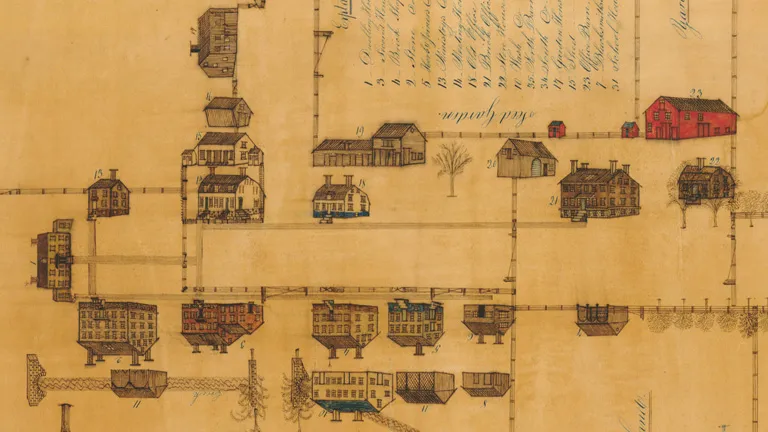
It is based on the hand-drawn map "A Delineation or View of the Village called the Church Family" by David A. Buckingham and shows the inventory of the Church Family’s structures and lands. The map portrays landscape features such as a botanical garden, pastures, pathways, and over fifty buildings, from shops and dwelling houses to minor structures.

Image courtesy of New York State Museum
Brother Austin’s drawing of Watervliet locates the buildings, annotates the purpose of several gardens, and positions the apple trees in the orchard, providing a complete understanding on how the Shaker residents occupied the site in the 1830s. The digital reconstruction of the structures are based on his representations, as described in Brother Buckingham’s letter to fellow Shaker Brother Isaac, on historical documents, and records from the Albany County Survey.
The digital reconstruction was originally developed by Virtual Grounds Interactive as part of the first iteration of the Virtual Watervliet Portal, launched in 2013. However, after Google transitioned Google Earth Web to a new format in 2017, access to the 3D tour was shut down. Virtual Grounds collaborated with Shaker Heritage Society to reassess the initial collection of digital assets, enhancing it for web-based 3D visualization technology, and relaunching as the 'Echoes of 1838' experience.